KEYNOTE PRESENTATIONS
Keynote Speakers
Keynote Presentations
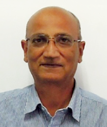
Venkatesh Raghavan
- BIOGRAPHY
- Prof. Venkatesh Raghavan is an alumnus of the Department of Geology, Pune University and obtained his Doctor of Science in Geological Remote Sensing from Osaka City University Japan in 1994. He is presently based in Japan as Professor of Geoinformatics at the Graduate School of Engineering, Osaka City University. His research interest includes geospatial Web Services, sensor network, Geo-Crowd Sourcing and remote sensing for change detection. Prof. Venkatesh Raghavan was one of the founders of the Free and Open Source Software for Geoinformatics (FOSS4G) global initiative in 2004. He has been involved in OSGeo Foundation (www.osgeo.org) since its inception in 2006. He was on the first OSGeo Board and was re-elected to again in 2015 and served as the President of the Foundation during 2016-2017. He is on the Advisory Board of the Geo4All initiative (www.geo4all.org). He plays active role in promoting FOSS4G in Asia.
Prof. Raghavan is currently Co-Editor-in-Chief of Spatial Information Research and is on the Editorial Board of International Journal of Geoinformatics and Applied Geomatics journals. He is the founder of ZOO WPS Platform Project which offers a comprehensive framework for deploying Geospatial-Software as a Service (Geo-SaaS). He is a team leader and member in several Geoinformatics projects and has vast experience in conducting national and international training programs and development of learning materials for RS/GIS using FOSS4G. He is actively involved in promoting Free and Open Source Software Solutions for Geoinformatics (FOSS4G) worldwide including organizing global, regional and national FOSS4G events.
He was awarded the Mining & Material Processing Institute of Japan Young Scientist Award in 1995. He has taken up visiting professor assignments at prestigious universities such as the Asian Institute of Technology, Bangkok and China University of Mining and Technology, Beijing. Prof. Venkatesh Raghavan was recipient of the 2012 Sol Katz Award for his contribution to the Open Geospatial Community and remains to be only Asian to receive this honour till date. - Beyond the Jargon: FOSS4G, OSGeo, Geo4All and ME4E
- Geo-enabled Information and Communication Technology (Geo-ICT) is the mainstay of several international and national initiatives. Geo-ICT research contributes to the development of various location-aware services using Global Positioning Systems (GPS), the Internet of Things (IoT), Sensor Networks (weather, environment, water/air pollution etc), and Remote Sensing (satellites, UAV’s). Applied Geoinformatics, using tools such as Geographic Information System (GIS) and Remote Sensing, supports an increasingly wide range of disciplines that include the arts, humanities, social/natural sciences and engineering.
Open Source Software, Open Hardware, Open Data and Open Standards constitute the four vital pillars supporting the implementation and deployment of interoperable and scalable Geo-ICT solutions for a variety of applications areas. A robust and customizable platform to facilitate Geospatial-Software as a Service (Geo-SaaS) forms the backbone of several citizen centric initiatives. Prudent and effective use of geospatial technologies requires the fostering of a highly skilled workforce for developing, maintaining Geo-ICT solutions for societal needsThe FOSS4G (Free and Open Source Solutions for Geoinformatics) initiative that began in 2004, has gained widespread acceptance the world over the 15 years. Since 2006, the Open Source Geospatial Foundation (OSGeo) has been spearheading the collaborative development of open source geospatial software and promote its widespread use. Active OSGeo Chapters have also been established worldwide to cater to specific local needs. As a part of the educational outreach and skill development, the OSGeo Foundation along with partner organizations such as the International Cartographic Association and the International Society for Photogrammetry and Remote Sensing has also established the Geo4All international network of universities and research institutions offering high-level training and sharing of knowledge and experiences to build a strong and vibrant geospatial workforce.
Further, in recent years, a wealth of geospatial Open Data has become available through international and national agencies but also through participatory data production initiatives such as the Open Street Map. Due to the proliferation of GPS-enabled devices, Crowd Sourcing and Volunteered Geographic Information has also facilitated easy gathering and value addition of open geospatial data. The past decade has also seen the maturity of international standards for geospatial data exchanges and interoperability though the initiatives of the Open Geospatial Consortium (OGC) and ISO.
This talk aims at demystifying the acronyms FOSS4G, OSGeo and Geo4all through temporal focus on the past, present and future. The speaker plans to narrate some anecdotes and personal experiences as experiential traveller the FOSS4G world. A gist of some new initiatives being undertaken and priorities for coming years will be outlined. Lastly, opportunities for joint industry-academia-government initiatives for collaborative innovation in mapping and cartography will be discussed. Some examples of leveraging the Free & Open geospatial ecosystem for deploying a participatory mapping framework to bring about positive social change will also be presented.
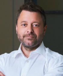
Steve Coast
- BIOGRAPHY
- Coast interned at Wolfram Research before studying computing science at University College London (UCL).
In July 2004, he founded the OpenStreetMap project (OSM).
Coast set up Z.X.V. Ltd. with Nick Black, Tom Carden and Ben Gimpert as a technology consultancy in 2005. In 2008 this became CloudMade after investment by Nikolaj Nyholm and Sunstone Capital (company's website claims it was established in 2007). He resigned from CloudMade in October 2010, although he remained a shareholder.[citation needed]
On 23 November 2010, Coast announced that he had accepted a position as Principal Architect at Microsoft's Bing Mobile.
On 3 September 2013, Coast wrote on his blog that he had started to work for TeleNav, taking care of OSM development for the company's Scout navigator.
In March 2014, Coast became an advisor to Auth0, an identity-as-a-service provider.
In November 2015, Coast published ""The Book of OSM"". The book contains 15 interviews conducted by Coast with various users who had participated in the project since its beginning.
In January 2016, he stepped down from full-time work at TeleNav and started his work as a board advisor in Navmii. In March 2016 he started working as Chief Evangelist for what3words. In May 2016 he became an advisor in MapJam. In fall 2017, he joined DigitalGlobe. In spring 2019 he joined TomTom as a vice president in the Maps department. - The Past, Present, and Future of OpenStreetMap
- Steve will be presenting on the past, present and future of OpenStreetMap – discussing how to edit, licensing, community and more. Steve will also discuss his book, “The Book of OSM”, containing interviews with 15 early adopters of OSM to capture the early growth and feeling of the project.
Ayako Kagawa
- BIOGRAPHY
- The United Nations Geospatial Information Section is an office responsible in providing strategic and tactical geospatial information management services to the United Nations Secretariat. The Section provides wide range of services including maps and guidance for UN official publications and customised geospatial services for the Secretariat; serves as the Secretariat function of the United Nations Committee of Experts on Global Geospatial Information Management (UN-GGIM); provides technical support on international boundary issues including administrative boundaries; and provides programme management support to United Nations field missions who have geospatial support components. The Section provides technology driven solutions to enable Secretariat colleagues who are entrusted by the international community to resolve challenging global mandates and missions.
Ayako Kagawa is a Chartered Geographer, serving the United Nations since 2003 in various capacity including thematic mapping for the United Nations Office on Drugs and Crime (UNODC), topographic mapping for the peacekeepers in the United Nations Disengagement Observation Force (UNDOF) and currently with the United Nations Geospatial Information Section. She provides policy guidance and operational support in the areas of cartography, geospatial information management, international boundaries and geographical names. Prior to the United Nations, Ayako has worked with Japan Map Center as a Planning Officer in Japan and as a research assistant and a lecturer in ITC (Faculty of Geo-Information Science and Earth Observation, University of Twente) in The Netherlands. - The Role of Cartographers in a Sustainable Development World
- The 2030 Agenda for Sustainable Development or also known as the Sustainable Development Goals (SDGs) is the new global paradigm and blueprint to achieve a better and more sustainable future for all. To collectively achieve the SDGs, the global community agreed on 17 Goals as a baseline framework to measure and monitor its growth. How to measure and monitor development progress by countries has been a long-standing debate since the era of Millennium Development Goals (MDGs) in the 2000s but with the establishment of Inter-Agency and Expert Group on SDG Indicators (IAEG-SDGs), the SDGs have a clearer framework on how to monitor progress and the global community are grappling on how to effectively collect, analyse, visualise and report their successes.
Within the United Nations, there is an attempt in providing principles and tools on how best to report the SDGs at country and local level as its success lies in the ownership and accountability at all levels. The Secretary-General of the United Nations has been anxious on how the use of technologies can accelerate the SDGs and to facilitate the alignments with the values enshrined in the United Nations Charter, the Universal Declaration of Human Rights, and the norms and standards of International Laws.
In this paradigm, what should be the role of cartographers and geospatial information management experts to ensure how maps and geospatial information can be effectively used by the global community at all levels to communicate their challenges and successes from planning to implementing, monitoring, analysing, visualising and reporting on sustainable development? This presentation argues the importance of listening the challenges, asking questions to the policy makers, sharing best practices and building a consensus on the issues surrounding the SDGs before demonstrating the diverse cartographic skills available to communicate the intended message better. Hence, the importance of context has never changed and provides the cartographic and geospatial information management community an opportunity to demonstrate the potential and a vision of maps for sustainable for all through better communication.
*The views expressed are those of the author(s) and do not necessarily reflect those of the United Nations.
Eric Gundersen
- BIOGRAPHY
- As CEO of Mapbox, Eric Gundersen oversees product, business, and marketing.
Eric started Mapbox to create tools that make location data powerful and available to everyone. Previously, Eric co-founded Development Seed, a consultancy that developed open source tools for international development agencies and nonprofits to map the world.
He holds a master’s degree in International Development, and a dual bachelor’s degree in Economics and International Relations from American University. - Building a living map of the world updated from billions of sensors
- Mapbox maps learn from every application they're embedded in. Over 640 million people use Mapbox every month. Every day these devices generate 14 billion anonymous sensor readings that are used to deliver precise traffic data and instantly ship over 100,000 daily changes to maps on any connected device. Using AI and machine learning, this information delivers precise, predictive drive times and finds the best routes for drivers.
Eric Gundersen, CEO and Founder of Mapbox, will speak about the future of mapping, from its roots with OpenStreetMap to sharing new plans on launching in Japan with SoftBank this summer. Gundersen will also do a live demo of this new AR Vision, turning cameras into co-pilots using AI-powered semantic segmentation, object detection, and classification to identify the variables that define a driver’s journey. This live data with distributed sensors can detect construction, recognize street signs and speed limits, and identify potential hazards to enable augmented reality navigation and automated driving.


